6 easy-to-reach Big Bear hiking trails


Pack your hiking boots, hit the trail, and wander through dense Douglas fir forests. Breathe in the scent of tall ponderosa pines and keep an eye out for squirrels, birds, and possibly even deer! You’re in Big Bear now, and that means adventure. Whether you're a first-time visitor or a seasoned traveler, these six hiking trails should be at the top of your list. After your day of exploration, cozy up in your Big Bear cabin rental for some well-deserved rest.
This unique Big Bear hiking path is the perfect spot to bring the whole family. Woodland Interpretive Trail is an easy 1.5-mile loop that has only 300 feet of elevation gain. In addition to being a great short workout, the hike is also educational. Grab a pamphlet at the entrance and follow the self-guided tour to learn more about the local flora, fauna, and geology.
To access the trail, drive around to the north side of the lake until you hit Highway 38. The entrance to the trail is about a quarter-mile west of the Stanfield Cutoff. You’ll need an Adventure Pass to park in the lot—be sure to grab one from the Big Bear Visitor Center.
A local favorite, Castle Rock Trail is a 2.4-mile round-trip journey that boasts breathtaking panoramic views of the valley. The first half-mile is steep, but it levels off when you reach the granite rock at the peak. Kids can join in on the fun, and they’ll love the seasonal stream that weaves through most of the hike. Although the 500-foot elevation gain may seem difficult on the way up, it makes your leisurely hike back down that much more enjoyable. Take time to search for insects, inspect the cedar and fir trees, and toss rocks into the nearby waterfall.
Castle Rock Trail is located just off Highway 18, a mile east of Big Bear Dam. Parking can be limited in the vicinity of this popular hike, but it’s one you won’t want to miss. Beat the crowds by hiking on a weekday or early in the morning.
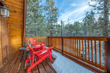
Castle Rock Cabin #2 is just a short walk from Castle Rock Trail 1W03. Here you'll keep plenty cozy, thanks to cabin-style decor and the comforts of home (like free WiFi, a well-equipped kitchen, and a gas grill). Gather around the fireplace in the evening, or take in the fresh air with a glass of wine on the deck.
Pick wildflowers while you meander through oak and pine trees along Pine Knot Trail, a moderate to difficult hike. Continue along the switchbacks through the forest as you climb 1,400 feet to Grand View Point, where you can spot San Gorgonio Mountain and Catalina Island in the distance. Allot three to four hours to complete this 6-mile round-trip hike.
Take Highway 18 to Big Bear Dam on the west side of the lake. Turn right and continue east along the highway until you reach Mill Creek Road. Take another right and you’ll find the trailhead parking lot at the Aspen Glen Picnic Area (note that you will need an Adventure Pass to park in this lot).
With 750 feet of elevation gain, Cougar Crest Trail ranks between moderate and difficult. So, if you’re looking for a heart-pumping workout with an incredible reward at the peak, this hike is for you! Bring plenty of water and snacks, as you’ll be taking on this 5.5-mile trail for about half the day. Also, be sure to pack a picnic lunch to enjoy at the summit of Bertha Peak.
The Cougar Crest Trail ends where it meets the famous Pacific Crest Trail, but if you continue down the dirt maintenance road you’ll reach Bertha Peak. On a clear day, you can take in amazing views of Bear Valley, Holcomb Valley, and the Mojave Desert.
Driving to this trail is a breeze, as it’s close to the Big Bear Discovery Center parking lot just off Highway 38. If you don’t mind walking the extra half-mile from the Discovery Center to the trailhead, you’ll enjoy free parking until 5 p.m.
Open seasonally from April through October, this long yet serene trail in Fawnskin is one you won't want to miss. Wind through patches of sunshine and shade as you climb the first portion of switchbacks. After you conquer the first steep section, the terrain levels off for the remainder of the 3.5-mile trail (7 miles round-trip). With 1,000 feet of elevation gain, Gray’s Peak Trail isn’t for inexperienced hikers and tends to be difficult for younger adventurers. However, if you’re up for a long journey through the woods, take the time to try out this challenging trail!
The Gray’s Peak path is only open seasonally due to its location in the middle of Fawnskin’s bald eagle wintering habitat area (on the north side of Big Bear Lake). Take Highway 38 to roughly half a mile west of Fawnskin, where you’ll see signs for the Grout Bay Picnic Area. Feel free to park anywhere in the picnic area lot, but note that you’ll need an Adventure Pass.
The Champion Lodgepole Trail is one of the most popular hikes in Big Bear. That’s because of the rare lodgepole pines that tower over the path. It’s a nice, easy stroll, and only around 1 mile round-trip with a 50-foot elevation gain. However, there are other ways to tack on some thrills.
You could easily hike in and out of Lodgepole, then head down the Siberia Creek Trail on your way back. While this adds an extra 12 miles round-trip, the scenery and seasonal wildflowers along the Siberia Creek Trail make the hike well worth the effort. Alternatively, you can go 2 extra miles round-trip to the Gunsight. The first mile is stunning, with colorful foliage in the fall and trickling waterfalls in the summer—not to mention some of the biggest ponderosa pines you’ll ever see. If you venture past the first mile, be prepared to climb down large boulders through the gorge to the end of the trail.
To reach these trails, take Mill Creek Road southwest and follow it to the left where it intersects with Tulip Lane. After another mile, the road will become dirt. Once you reach 2N11, take a left and follow the signs to the parking area. You will need an Adventure Pass to park in this lot.